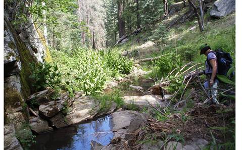
Barbershop Canyon
|
|
|
|
|
|
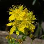
Hypericum scouleri |
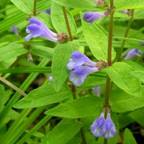
Scutellaria galericulata |
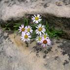
Erigeron saxitilis |
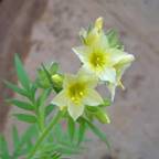
Polemonium
foliosissimum |
|
Coordinating Botanist: Glenn Rink Status: Completed except for vetting previous
collections Started: 2008 Taxa List |
|
|
|
Barbershop
Canyon is a deeply incised drainage cut into the Coconino Sandstone of the
Mogollon Rim, draining 20 miles to the north via East
Clear Creek into the Little Colorado River. Vegetation on the ridges above ranges from
Ponderosa Pine forest to mixed conifer at the upper elevations. These ridges and the upper draws host a more than 60 perennial springs, which contribute to the
incredible diversity of plant species found in the area. The
site is under Coconino National Forest management, and falls between Dick
Hart Ridge and Dane Ridge, north of the Mogollon Rim Road #300. It encompasses Barbershop Canyon and its tributaries
(including Dane Canyon), up to the point where the canyon meets East Clear
Creek. A number of USFS dirt roads
access the ridges between the tributaries and many of the springs in the
upper draws. A few hiking trails drop
into the canyons, but most hiking is rugged cross-country or boulder
hopping up the canyon bottoms. Elevations range from 6500’ at the confluence
of Barbershop &Clear Creek, up to 7800’ along the Rim Road. Barbershop Canyon was the location of the first PAPAZ training trip in
the summer of 2008. The specimens collected then were added to vouchers that
Glenn Rink had been collecting in the area earlier that year. Subsequently, Glenn and several other
botanists returned to continue the effort and cover portions of the area not
visited previously. The vouchered list
produced by this effort contains close to 450 taxa. |