Kanab Creek Wilderness Area
|
|
|
|
|
|
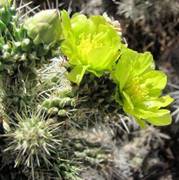
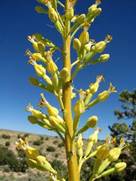
Cylindropuntia
whipplei var. whipplei |
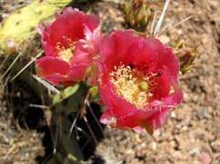
Opuntia cf. phaeacantha |
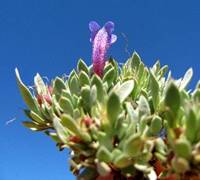
Penstemon
thompsoniae |
Agave utahensis ssp.
utahensis |
|
Coordinating Botanist: Wendy Hodgson Status: In Progress Started: 1998 Taxa List. Being compiled. |
|
|
|
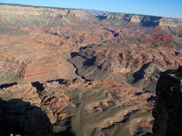
Kanab Creek Wilderness
Area (KCWA) encompasses 75,300 acres (305 km2), of which 68,600 acres (278
km2) are located in the North Kaibab Ranger District of the Kaibab National
Forest, and the remaining 6,700 acres (27 km2) are administered by the Bureau
of Land Management. Kanab Creek is the
major tributary and largest north of the Colorado River, positioned along the
major fault separating Kanab and Kaibab Plateaus, originating approximately
50 miles north of the Wilderness boundary in southern Utah. It is a perennial
stream for much of its lower length, and during the summer months (July –
September) can experience flash flooding – BE AWARE. Major tributaries flowing into Kanab Creek
from the east are Snake Gulch and Jump Up Canyon; secondary drainages of
these canyons are Slide Canyon, Horse Spring, Sowats, Kwagunt Hollow and
Indian Hollow. Other side drainages flowing into Kanab Creek from the east
are Little Spring, Jensen, Big Cove, Dinner Pockets and Lawson canyons. Major
tributaries flowing from the west into Kanab Creek are Grama, Hack and
Chamberlain canyons. Steep-walled
drainages characterize much of the area below the Esplanade. The Esplanade is broad and expansive and is
characterized by relatively level terrain, pot holes and sculptured rock
forms, all providing microhabitats to a diverse assemblage of plants. Elevations within KCWA range from ca 6200
feet (1878 meters) on the rim at Sowats Point to 3200 feet (970 meters) below
Jump Up Canyon-Kanab Creek junction. The rugged nature of KWCA and adjacent
areas require access via 4WD or backpack.
One can gain access via the following roads leading into several
trails: FSR 642 from FSR 22 (or FSR 642) to Snake Gulch, Trail #59; FSR 235
off of FSR 423 and FSR 423 to Slide Canyon Trail #58; FSR 234 from FSR 447
and FSR 22 to Ranger Trail #41; FSR 227 from FSR 427 to Gooseneck Trail #112;
and FSR 233 from FSR 425 to Jumpup-Nail Trail #8. The relative difficulty of
access is a factor in the relatively low number of collections and collectors
in this area. Nearly 600 collections representing
358 taxa have been made
within the parameters of 36.47° - 36.9° N lat. and 112.65° - 112.44°W long, an area that
approximates the areas within the KCWA.
There remain
extensive areas both along and below the rims requiring further plant exploration and documentation. The threat of expanded uranium ore mining
at known breccia sites demand botanical inventories for rare plants such as Rosa stellata ssp. abyssa. Very little is known regarding
species of concern in or near federal lands available for mineral (uranium
resources) development, including 1) what exactly grows at these sites,
including sensitive species and their abundance, 2) sensitivity and potential
chemical toxicity of the plants (rare or not) to uranium and 3) what their
present uranium concentration is in their tissues and how this affects the
plants (Bills et al. 2011. U.S. Geological
Survey Fact Sheet 2010-3050). Areas targeted for study in the immediate
future include further reconnaissance of rim areas from Jump Up Point to
Snake Gulch (and include Jensen, Big Cove, Lawson canyon rims), Sowats, Rock,
Little Spring, Horse, Pigeon, Wildband and White Pockets canyons and rims,
and Gunsight and Buckhorn Points. |