Salero Ranch
|
|
|
|
|
|
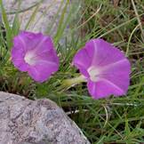
Ipomoea capillacea |
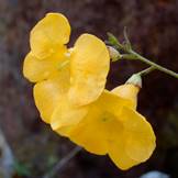
Brachystigma wrightii |
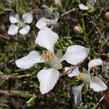
Fendlera rupicola |
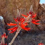
Erythrina flabelliformis |
|
Coordinating Botanist: Sue Carnahan Status: In Progress Started: 2013 |
|
|
|
|
|
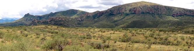
Salero Ranch is a 16,000-acre cattle ranch located in Santa Cruz County, sandwiched between the Santa Rita Mountains to the north and Coal Mine Canyon and Sonoita Creek State Natural Area to the south. The Salero was part of the controversial Baca Float No. 3 land grant authorized by Congress in 1863 and has been privately held since that time; it also contains the ruins of some of the oldest silver mines in North America, dating back to the early 1700s or perhaps earlier. The current ranch owners run 200 head of cattle and have platted two-thirds of the ranch into 36-acre custom home sites; there are at present 19 homes and over 30 miles of dirt road within the ranch boundary. I obtained permission from 138 private land owners to include their parcels in the study area, giving me effective access to about 85 percent of the Salero. The habitat of Salero Ranch is mostly semi-desert grassland, with seasonal riparian areas, mountain canyons, and oak woodland. Elevations range from 3800 to 6400 feet; the landscape is rocky and heavily dissected and features several perennial springs, as well as dirt and cement-dam cattle tanks. My working flora list, based on observations and a handful of prior collections, stands at 637 species of vascular plants, with over 600 documented since 2013 through voucher collections. Species of note include Croton ciliatoglandulifer, Graptopetalum bartramii, Metastelma mexicanum (Cynanchum wigginsii), Fuirena simplex, and Microchloa kunthii. The focus of current fieldwork is on more thorough documenting of winter-spring ephemerals and exploration of hard-to-access canyons and high elevation areas. |