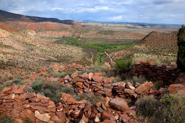
Upper Verde River
|
|
|
|
|
|
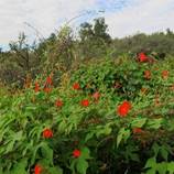
Ipomoea
cristulata |
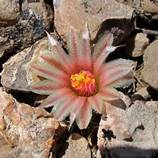
Coryphantha
missouriensis |
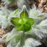
Cryptantha
cinerea |
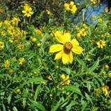
Bidens laevis |
|
Coordinating Botanist: Frankie
Coburn Status: In Progress Started: 2011 |
|
|
|
|
|
The Verde River is a main tributary in the lower
Colorado River Basin and possesses one of the longest remaining stretches of
wild, unregulated river in the southwest. The upper section flows through the
Central Highlands of Arizona from the headwater springs near Paulden, in the
Chino Valley at 4500 ft, southeast ca. 45 river miles to Clarkdale, in the
Verde Valley, at 3000 ft. This remote stretch of the river rolls through alternating canyons
and valleys incised into a mosaic of geologic formations. Covering the
hillsides and canyons are expanses of Great Basin/Plains Grassland, Pinyon
Juniper Woodland, Interior Chaparral, Desert Grassland and upper Sonoran
Scrub, these all bisected by the riparian woodlands, meadows and floodplains
of the Verde River. This variety of habitats and geology hosts a diverse
assemblage of plant species including narrow endemics that grow on limestone,
plants from various regions, shady mesic associations in canyons, and
abundant riparian vegetation along the river bottom. The combination of a vital perennial water source, and the abundant wildlife
and ecosystems it supports, combined with the scenic surroundings and
cultural resources have led to conservation efforts to protect both the Verde
flows and the landscape they flow through. Despite the values of this special
area, no complete floristic inventory existed before this project. The study area includes
the Upper Verde riparian corridor, tributaries, their canyons or valleys and
the surrounding rims, mesas and hills to a distance of approximately
1-1.5km(0.62mi) on both sides of the river, forming an area of approximately
37,065 acres (1500 hectares, 58mi2). The majority of this stretch is remote backcountry
but many areas are easily accessible, offering opportunities from moderate
day hikes to multi-day backpacking and car-camping trips. With very few
maintained hiking trails, travel is done mostly by route finding through
riparian forests, hiking along rims and hillsides, and wading and boulder
hopping along the river. From Prescott/Chino Valley the best access is via Hwy
89A to Verde Ranch Road and FR 318 Perkinsville Road which runs from Chino
Valley to Jerome. The best access points from Clarkdale/Cottonwood are off of
FR 131, Sycamore Canyon Road. These roads are maintained but many roads and
trails that split off require a high-clearance/4-wheel drive vehicle. So far, 690 species have
been vouchered and inspection of additional collections will likely bring the
number of taxa to over 720 species. Many areas are left to be thoroughly
collected and the spring flora needs to be targeted in various areas. Many
remote rims and some of the riparian sections in particular need attention
and its likely new species will be added from these areas. New species are
added to the flora each time we visit so the potential to make contributions
is very high. |